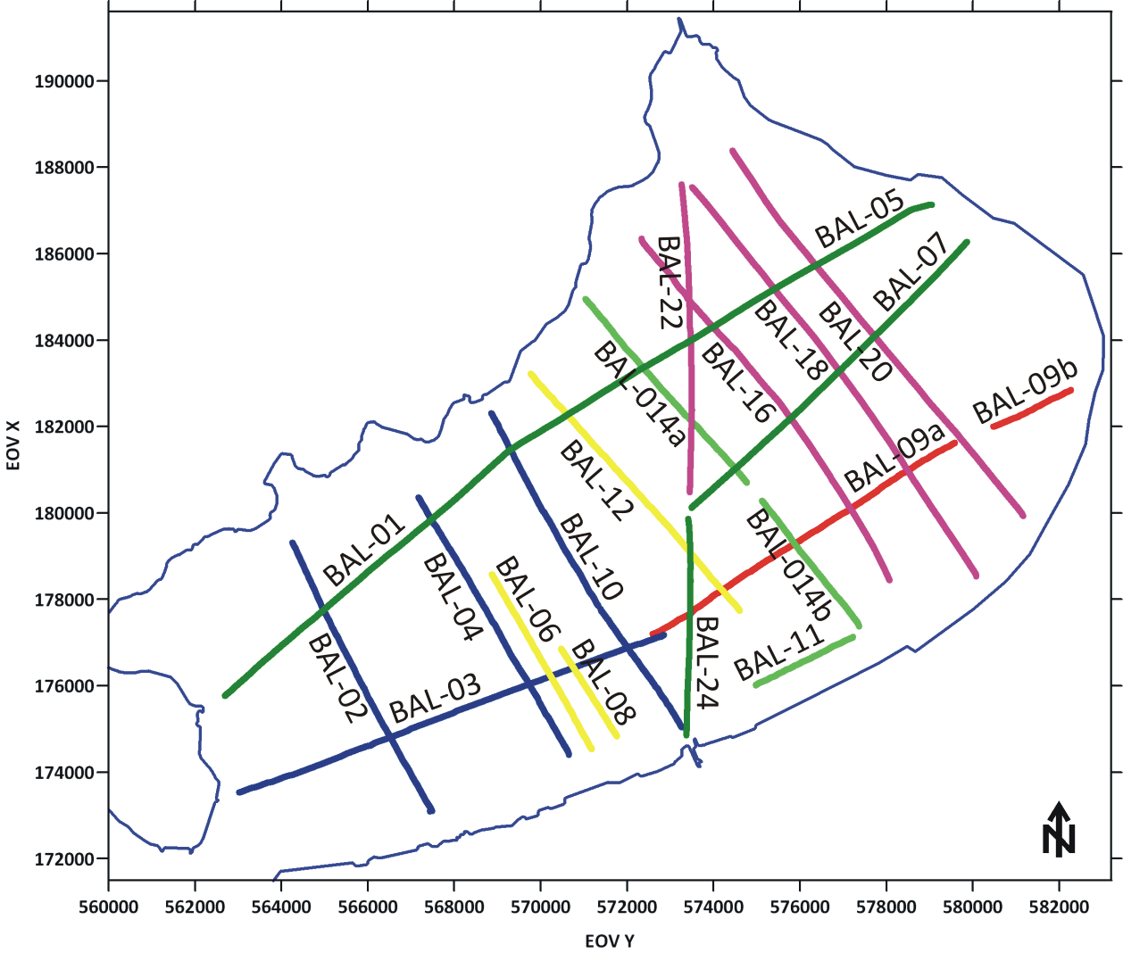
Multichannel seismic survey on Lake Balaton, Hungary
| |
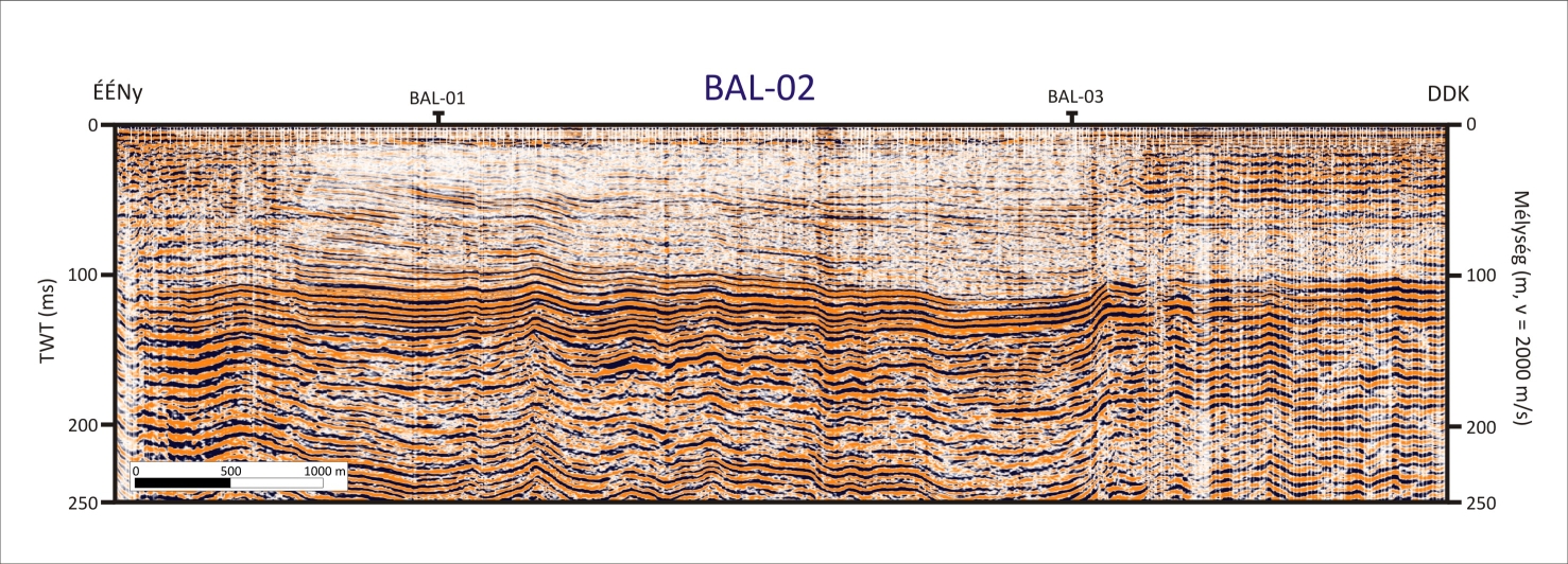
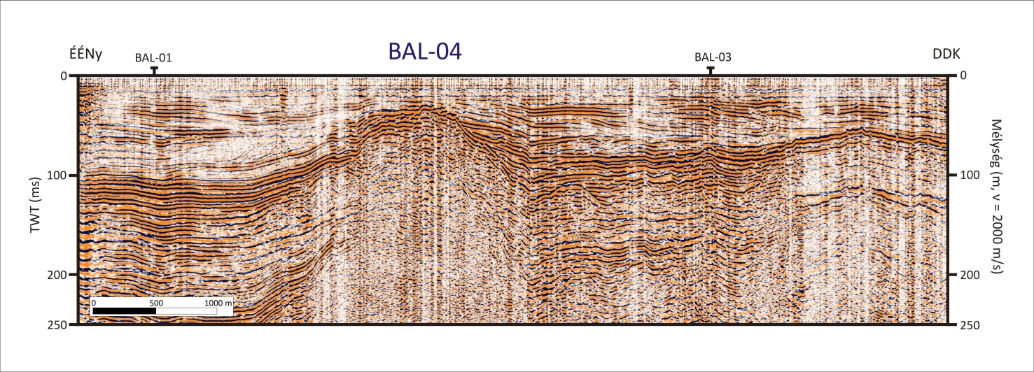
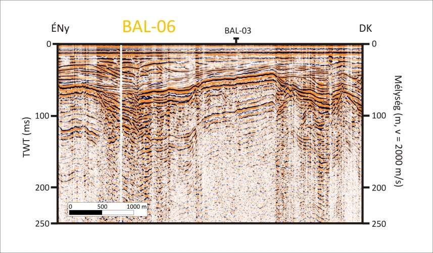
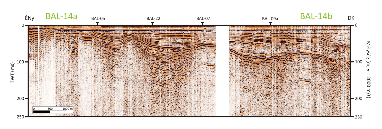
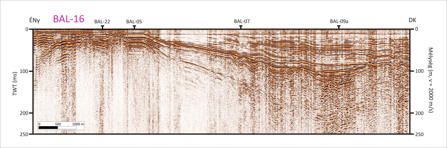
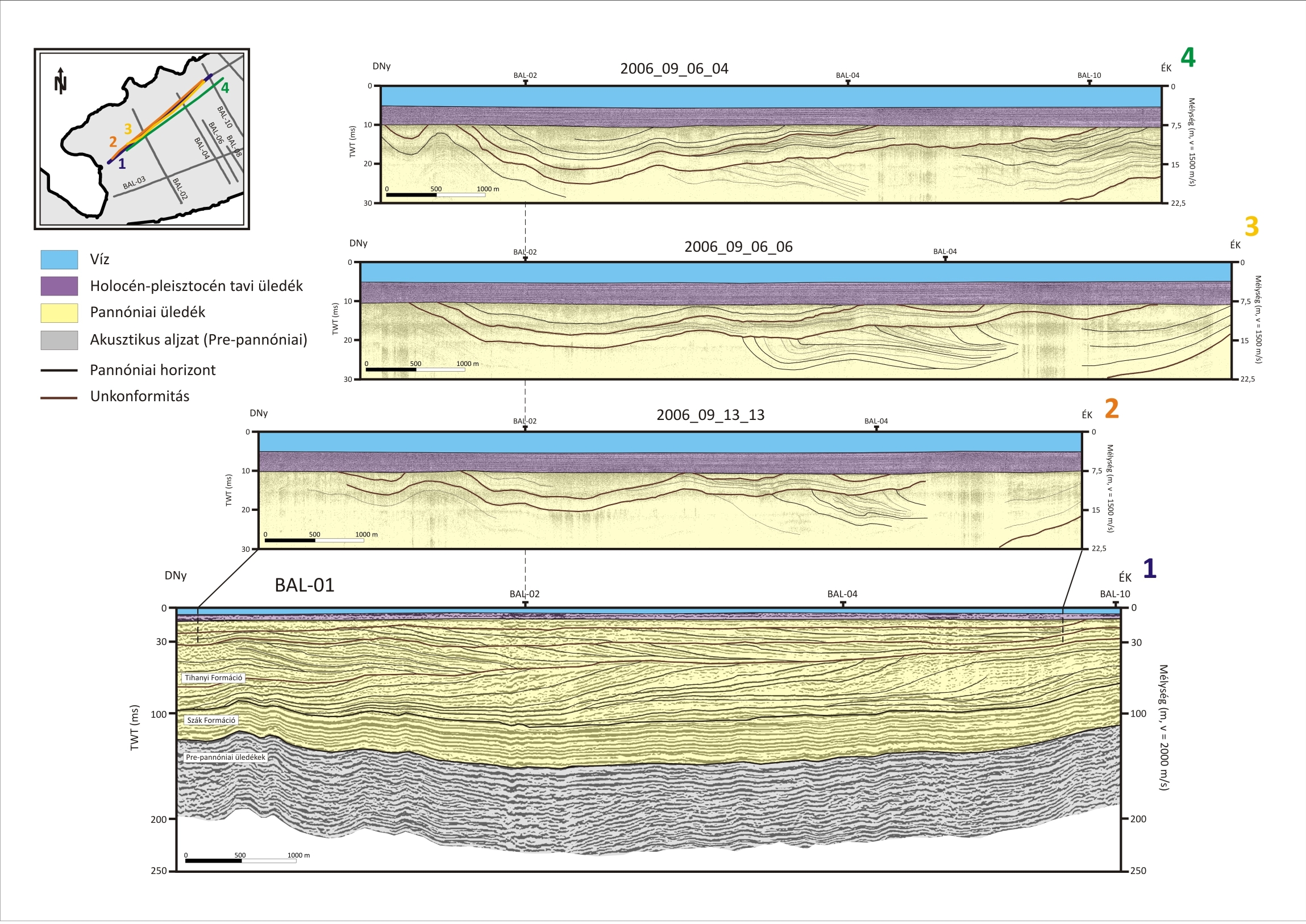
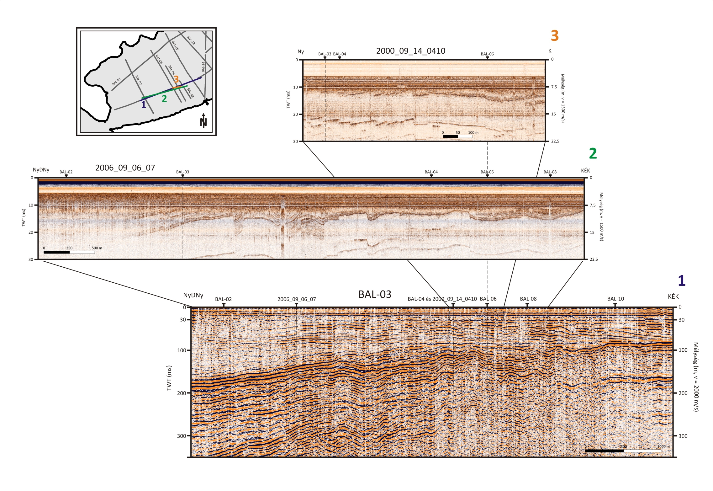
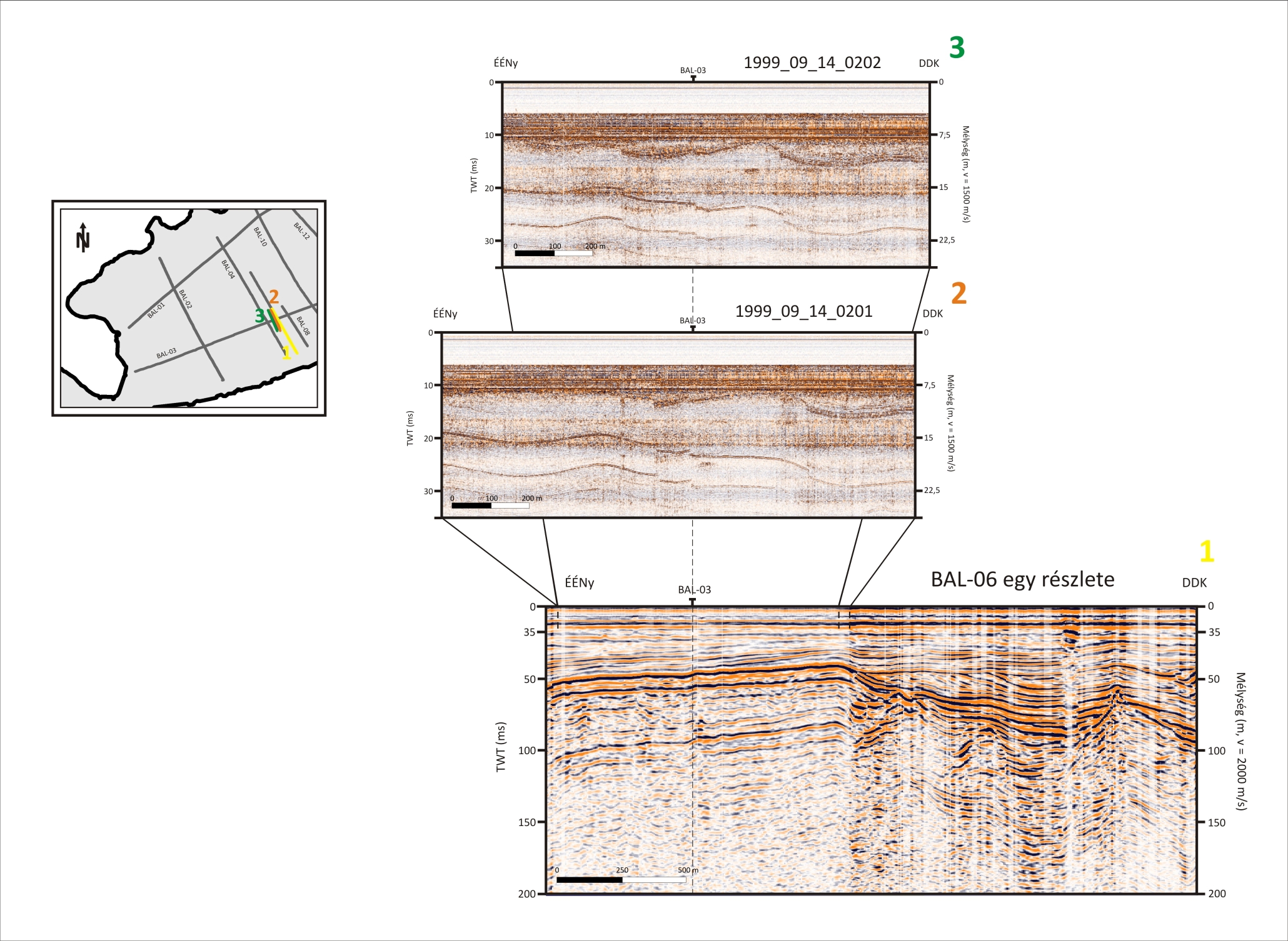
| BAL-02 | BAL-04 | BAL-06 | BAL-10 | BAL-12 | BAL-14a-b | BAL-16 | BAL-18 | BAL-20 |
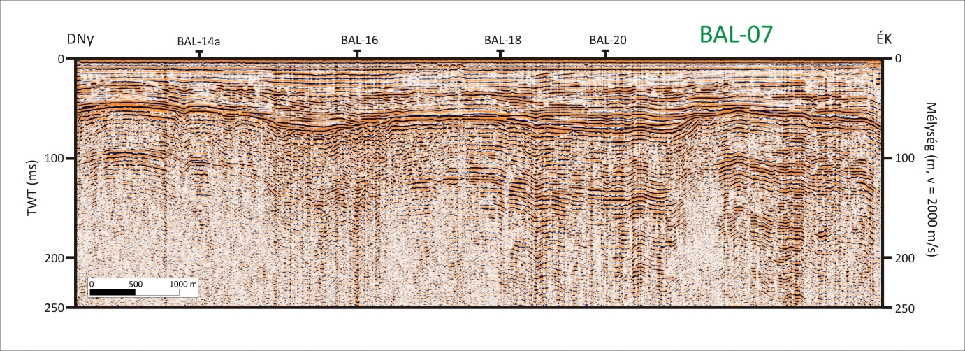
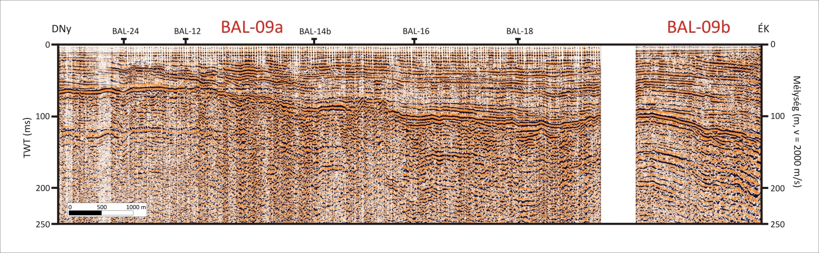
| BAL-01 | BAL-03 | BAL-05 | BAL-07 | BAL-09a-b | BAL-11 | |||
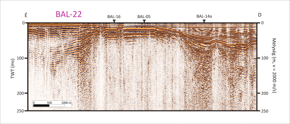
| BAL-22 | BAL-24 |
| BAL-01 and its interpretation |
| BAL-03 and its interpretation |
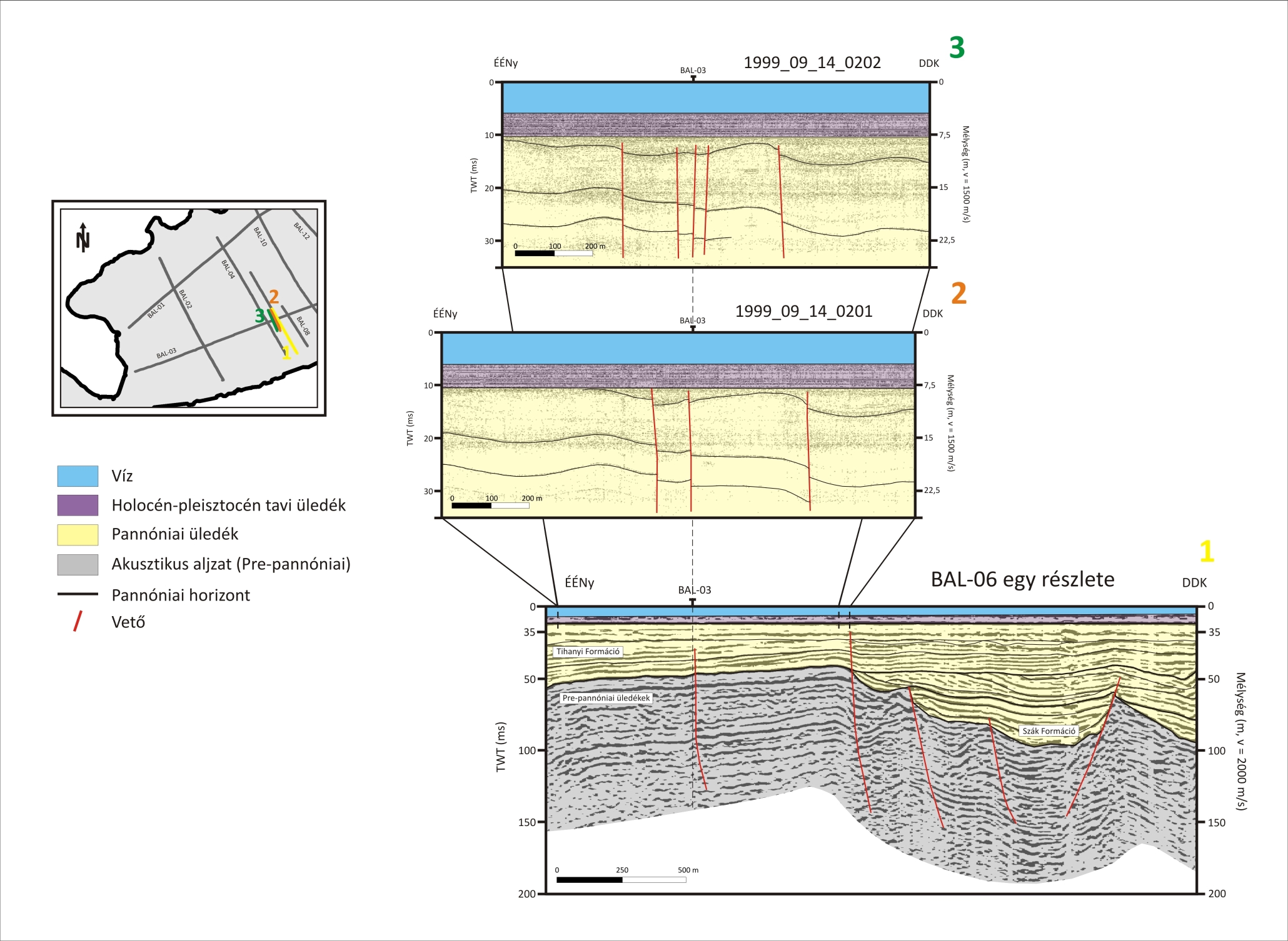
| BAL-06 and its interpretation |